|
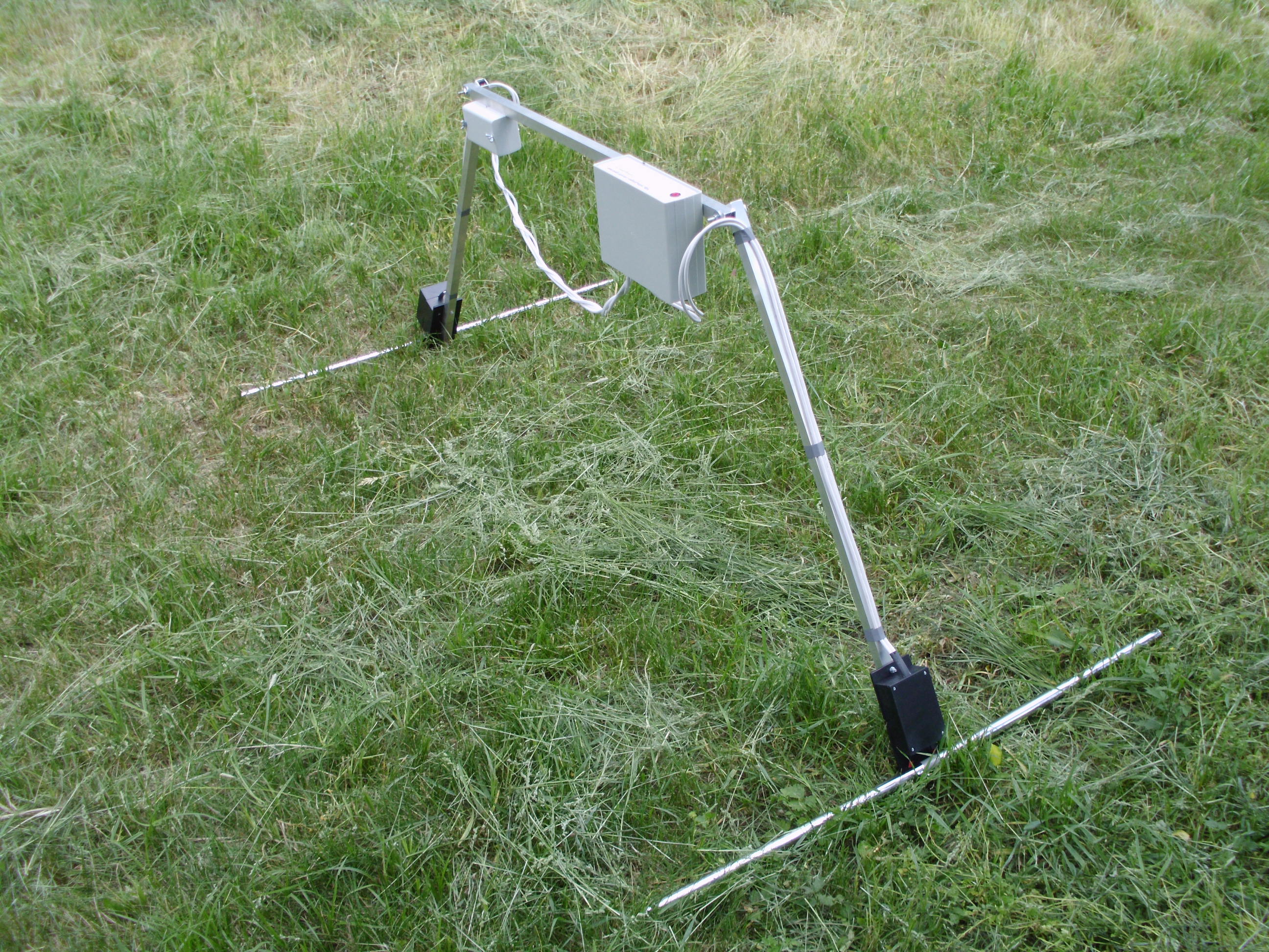
General
view of the ground
penetrating
radar
(GPR)
|
|
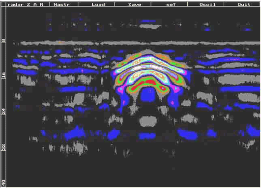
A
typical radargram over
a
small cave
|
|
This ground penetrating radar (GPR) has been designed
by Dipl. Eng. Petar Vulchev. The GPR can
identify subsurface heterogeneities, such a cavities, tunnels and other objects.
It is excellent to survey in rocks and sands, good in rather dry soils without clay, and useless in soils with clay and wet soils.
The recorded signals are analyzed by special software, developed by Dipl.
Eng. Vulchev and the results immediately appear on the laptop display.
One can use any laptop (1.4GHz or higher) with Windows XP, Vista or higher, and
an available USB port. The GPR can be carried by a single operator. In the sounding process, the operator is getting real-time information as a radiolocation profile (radargram) on the PC display. The GPR draws the radargram for 60 seconds (in this time
the operator can see the received part of the radargram), then the operator can
save the results on a hard disc as a text or raster file.
Find
more information at https://sites.google.com/site/vgeoradar/
|